
1·
8 days agoThanks!
Thanks!
Thanks!
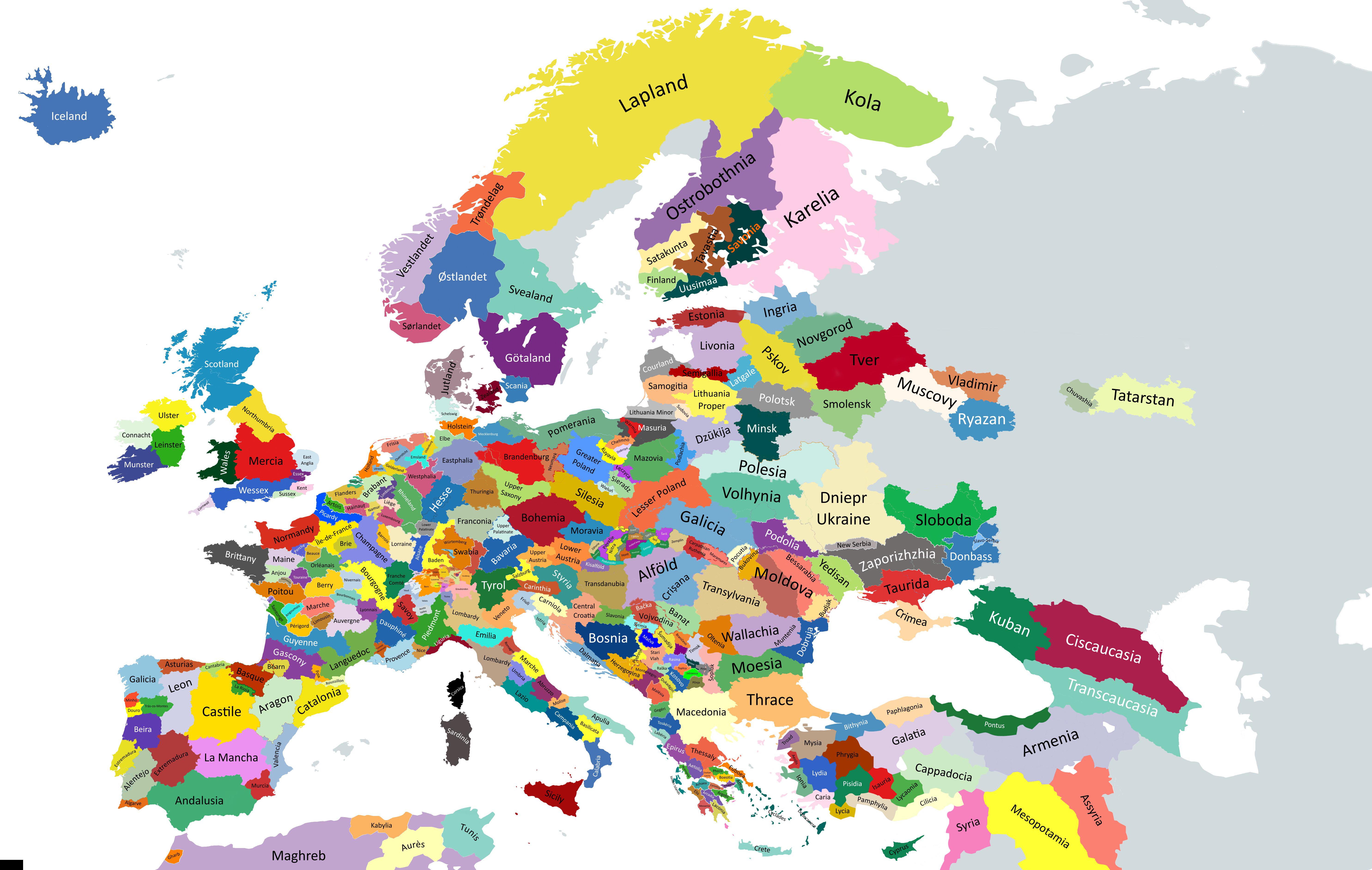
I had a look, they represent my trips to Italy. Curious to see what Italians think.
Glad to hear you got lucky!
Thanks!

Mbin is the new kbin. http://fedia.io/ if you want to have a look

It’s always interesting to see how less active this one is compared to the ones on Jlai.lu.
Because nobody brought it up for the previous version of the map. The author is going to update it for the next version
Seems like you were not the only one complaining: https://old.reddit.com/r/germany/comments/1fabllc/need_help_drawing_historical_regions_of_germany/
Updated the post (and posted a comment below) with additional input from the map author
Found this additional input from the map author in the post:
Here is the explanations comment
The main reference maps are here.
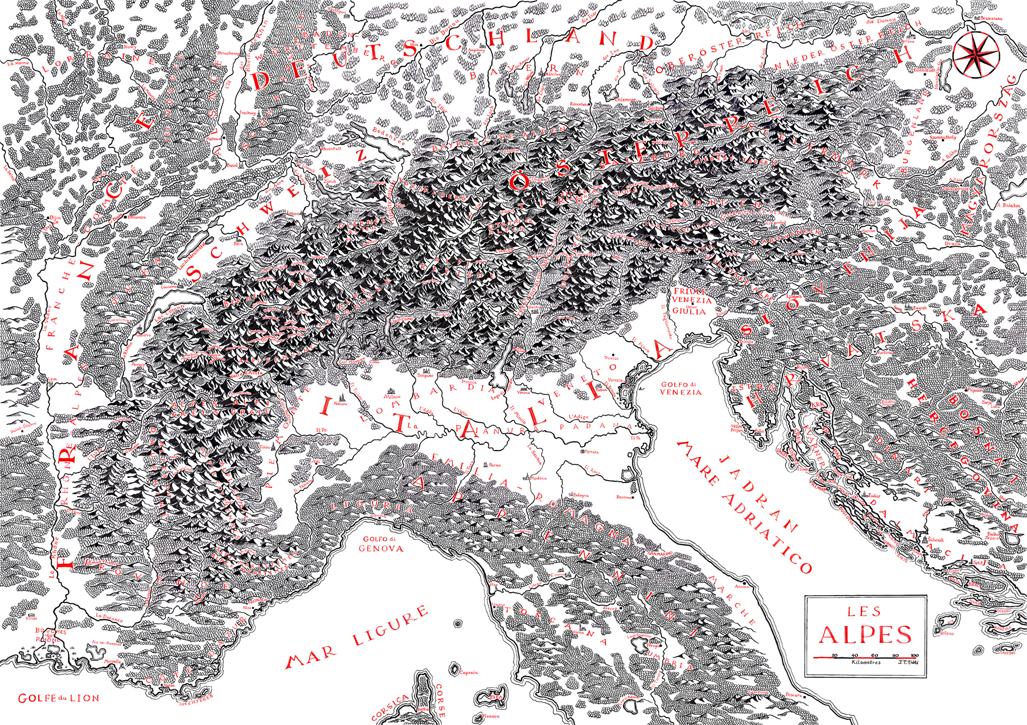
This map is based on geographical/historical/cultural regions division of Europe. The base canvas that has been used is Europe-Detailed from MapChart and it sucks because every country is overstretched with some parts like Germany and the Balkans being highly deformed. The overstretched Scandinavia was so unworkable I replaced it with HOI4 MapChart (it was already too late when I discovered MapChart has Paradox Interactive maps). If I make a final version, I will probably use HOI4 provinces as my base canvas because they provide enough fragmentations and countries are not that much deformed.
Since this map is intended to be used for studying History, I tried to focus on historical regions (which are often cultural regions too). When I couldn’t use historical regions because it was too complex or because of a lack of data, I resorted to geographical regions.
So, now here are some details about the regions I chose to display :
If you want to make an improved map or a variation map, feel free to use this unfinished map.
Note : If you have some remarks, I think it would be better to write them on a separate comment and not reply to this one to avoid creating an unending thread of replies.
Note 2 : Feel free to provide more detailed maps of specific regions of Europe, it may save some time for people struggling to find what they want.
Why? I mostly know France and Belgium, and it’s quite accurate
Discussions in French
French-speaking countries
For news
Welcome to the European frenzy (Croatia moved to Schengen since then)

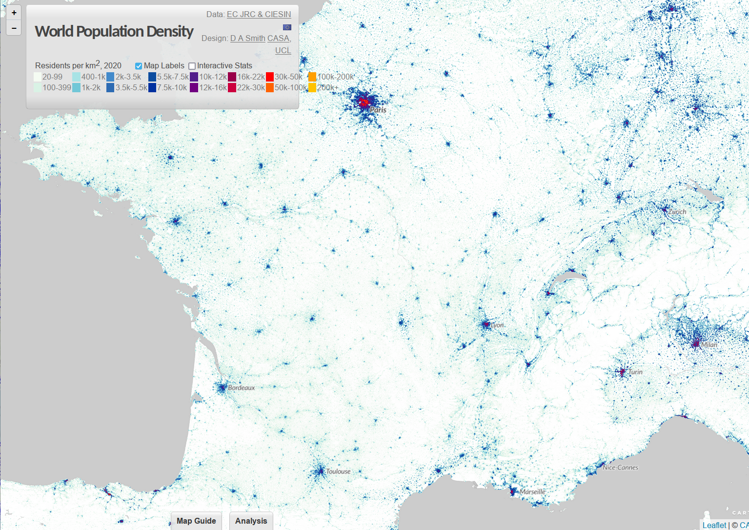
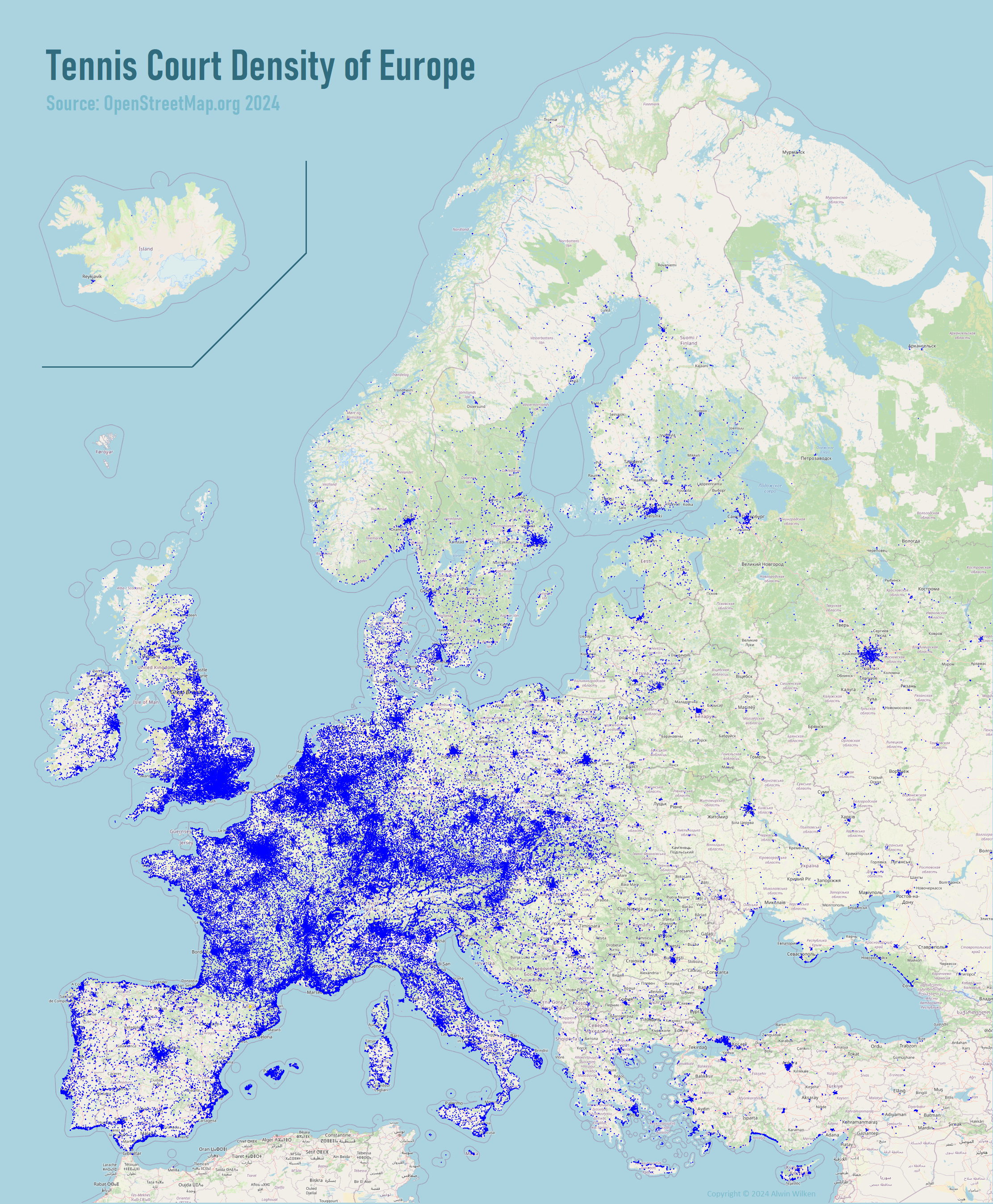
Using http://www.luminocity3d.org/WorldPopDen/#10/44.1517/0.0082
The West of France seems to have a high number of tennis courts for the population, probably because it’s a a tourist area.
Very interesting question, I had to do some research to find out (especially since the Brexit and UK is not included in Eurostat data anymore)
If we look at NL vs England
This map shows the difference, in the NL it’s more spread while in England it’s focused on the big cities

Source: http://www.statsmapsnpix.com/2020/04/population-density-in-europe.html
This interactive map also shows the data: http://www.luminocity3d.org/WorldPopDen/#8/51.856/3.705


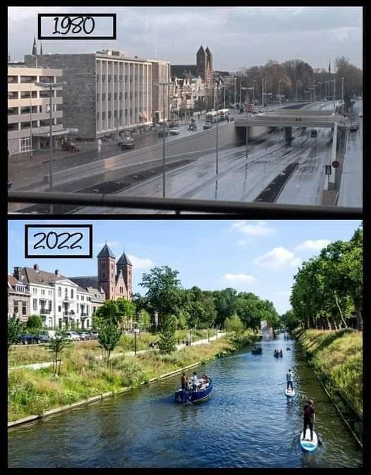
Beautiful!